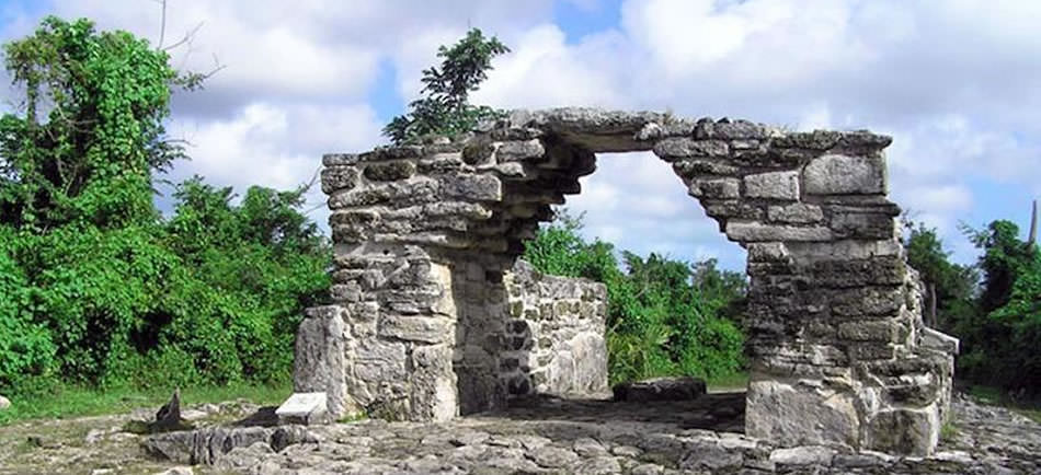
Balamkú
Balamkú, meaning “Temple of the Jaguar” in Mayan, is an archaeological site nestled in the Yucatán Peninsula. This hidden gem offers a unique glimpse into the rich history and culture of the ancient Mayan civilization.
Unlike the more crowded sites of Chichen Itza, Uxmal, or Tulum, Balamkú provides an intimate and serene experience, allowing visitors to explore its well-preserved structures and intricate stucco friezes at a leisurely pace.
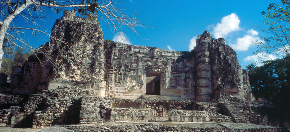
Balamkú is renowned for its extraordinary stucco friezes.
Balamkú is most famous for its spectacular frieze depicting scenes from Mayan mythology and daily life, which remains one of the best-preserved examples of Mayan art, showcasing the artistic prowess of the Mayans.
Balamkú is a must-visit destination for anyone interested in ancient Maya history and archaeology. Its location with the stunning natural environment and the well-preserved ruins, offers a unique and enriching experience.
Balamkú promises an unforgettable journey into the ancient Mayan world.
Geography and Environment
Surrounded by dense tropical rainforest, Balamkú is a haven for biodiversity, with lush vegetation and a variety of wildlife. The tropical jungle setting adds to the mystique of the site and offers a cool respite from the heat.
The environment around Balamkú is typical of the Yucatán’s tropical climate, with a mix of lowland jungle and limestone karst formations. The terrain is relatively flat, making it accessible for visitors of all ages and fitness levels.
The Best Time to Visit Balamkú
The best time to visit the Balamkú archaeological site is from November to April, when the weather is more temperate, a lower humidity and fewer chances of rain, making it ideal for exploring the ruins and surrounding jungle.
Temperatures typically range from 24°C to 28°C. Visiting in the early morning or late afternoon can also enhance your experience, as these times offer cooler temperatures and the opportunity to see wildlife at its most active.
History and Chronology
According to the latest research, Balamkú was first occupied around 300 BCE, during the Late Preclassic period, and continued to thrive through the Terminal Classic period, between 800 and 1000 CE.
The earliest architectural remains in Balamkú date back to the transition from the Late Preclassic (300 BCE – 250 CE) to the Early Classic period (250 CE – 600 CE), reflecting the site’s long-standing significance in the region.
Modern History
Balamkú was discovered in 1990, by Mexican archaeologist Florentino García Cruz.
While investigating reports of archaeological looting, Cruz and INAH custodians stumbled upon a looters’ trench that had a remarkably painted stucco frieze. Following this discovery, initial rescue efforts were undertaken to protect the site from further damage.
Formal excavations began in earnest between 1994 and 1995, spearheaded by Mexican archaeologist Ramón Carrasco. Carrasco’s team focused on the Central Group, meticulously uncovering and preserving the site’s architectural and artistic wonders.
Simultaneously, two French archaeologists, Claude Baudez and Jean Pierre Courau, directed their efforts toward the South Group, contributing significantly to our understanding of Balamkú’s historical and cultural context.
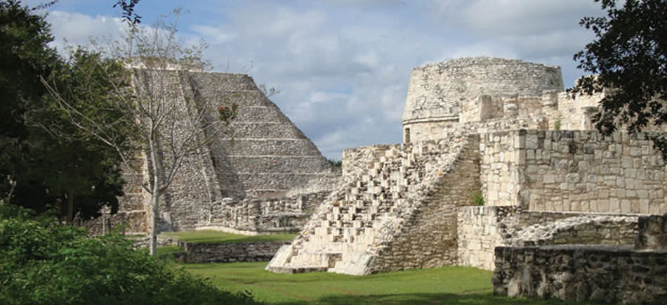
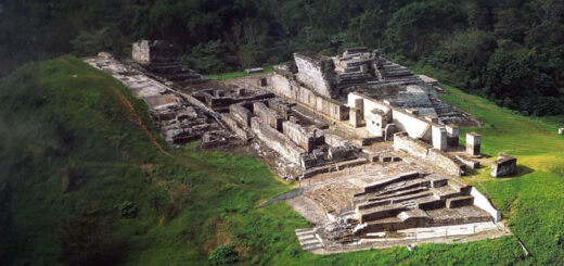
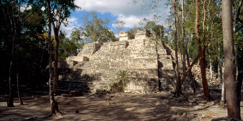
Balamkú Archaeological Zone
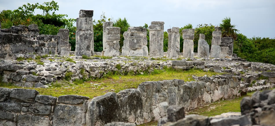
Balamkú spans approximately 25 hectares and is organized into four main architectural groups: the Central Group, South Group, Southwest Group, and North Group, each featuring distinct plazas and structures.
The Central Group, located in the southern part, includes a Mesoamerican ballcourt, several unexplored mounds, and various structures that exhibit architectural remains dating back to the Late Preclassic period.
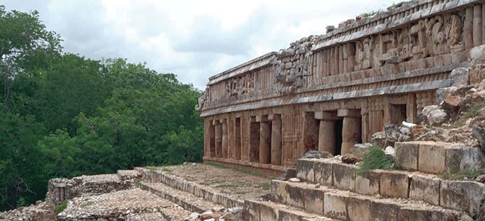
The Palace of the Four Kings in the Central Group features a well-preserved stucco frieze depicting rulers and sacred motifs. This frieze, initially discovered by looters, underscores Balamku’s rich cultural heritage.
This is the best-preserved carvings and stucco work in the region.
The friezes depict a range of scenes, from mythological narratives to everyday life, showcasing the daily Mayan culture. The vibrant colors and intricate designs are a testament to the skill and creativity of the ancient artisans.
In the South Group, which consists of four plazas, each plaza is defined by surrounding structures that provide evidence of the site’s development over time, spanning from the Late Preclassic era (300 BCE – 250 CE) through later periods.
The Southwest Group forms an astronomical complex, showcasing Balamku’s alignment with celestial events, and underscores the site’s integral role in the spiritual and ceremonial practices of the ancient Maya civilization.
The North Group of Balamkú, while not extensively excavated, comprises 6 plazas bordered by towering structures that hint at their potential ceremonial or administrative roles within the site’s broader urban layout.
The North Group area presents an intriguing opportunity for further archaeological exploration, promising deeper insights into Balamku’s societal organization and architectural complexity across different historical periods.
How to get to Balamkú Ruins?
The nearest towns and villages:
- Tulum is approximately 45 km away
- Coba ruins are located about 20 km
- Valladolid is about 60 km from Balamkú
Renting a car is the most convenient way to explore the area. Buses and colectivos (shared vans) run between major towns and can drop you off at nearby points. From there, a taxi or a short bike ride can get you to the ruins.
Several tour operators in Tulum and Coba offer guided trips to Balamkú.
Tourist Information
- Balamkú Ruins are open to visitors from 08:00 to 17:00 daily.
- The entrance fee is generally modest, around 75 MXN (2024).
What to bring and what to wear?
Bring water and snacks. Ensure you stay hydrated, as exploring the ruins can be physically demanding, especially in the heat. Light snacks or energy bars can keep you fueled during your visit.
Wear sturdy, comfortable shoes suitable for walking and climbing, as the terrain can be uneven. Opt for lightweight, breathable clothing to stay cool. Long sleeves and pants can also help protect against insect bites.
Protect yourself from the sun with a wide-brimmed hat and sunglasses. The area can have mosquitoes, especially during certain times of the year, so bring repellent to avoid bites.
Capture the beauty and history of the ruins, but remember to respect any rules regarding photography. Enjoy your exploration of Balamkú Ruins, and immerse yourself in the fascinating history they offer!